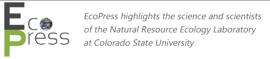
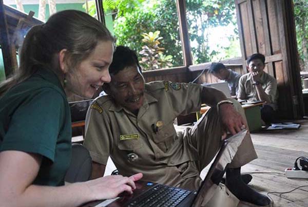
Last year, I began a collaboration with the Gunung Palung Orangutan Conservation Program (GPOCP) to evaluate critical habitat for the endangered Bornean orangutan in Gunung Palung National Park, and throughout the Kayong Utara and Ketapang Regencies of Borneo, Indonesia. The GPOCP is a registered non-governmental organization (NGO) known in Indonesia as Yayasan Palung, which was established in 2000 by Dr. Cheryl Knott, an Associate Professor at Boston University who has been leading research in Bornean orangutan biology and behavior for over 20 years. Gunung Palung National Park is a biodiversity hotspot, and is critical habitat for Pongo pygmaeus wurmbii, the orangutan species that is the focus of Dr. Knott’s research.
Geospatial modeling and analyses can be used to quantify the area most suitable for a species, and can be incorporated into decision support systems for land management planning and policy recommendations. I am collaborating with Dr. Knott and Cathryn Freund to model critical Bornean orangutan habitat using historical feeding tree data collected by GPOCP. Map results from this research will provide explicit geographic information that can be used to enhance monitoring efforts and conservation planning in the region. Stay tuned! We have a working manuscript draft that will be submitted soon for publication.
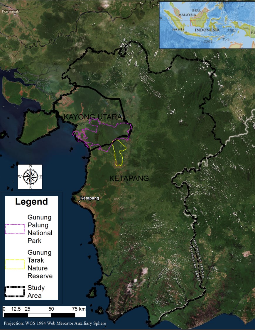
In March and April 2016, I had the wonderful opportunity to visit the study area and share my knowledge and experience in geographic information systems with teams from GPOCP, Gunung National Park, and local villages.
Maps are a form of communication that go beyond language barriers; that is one of the things I love most about making maps. It is also why I strive to share my knowledge and experience in map making with a broad audience. To prepare for workshops in Ketapang and Kayong Utara, I developed QGIS tutorials with a focus on the country of Indonesia. QGIS is an open-source program that can be used to manage, visualize, and process geospatial data. Anyone can go online and find tutorials for all skill levels of QGIS; from adding data in the map interface to advanced geostatistical algorithms. However, I have been teaching GIS to students who are new to geospatial sciences for almost five years and in these experiences, place-based tutorials provide more tangible and enduring curricula. Using open-source online data, I derived vector data of Indonesian cities, provinces, and regions, and raster data of elevation, mean annual temperature, and mean annual precipitation for Ketapang and Kayong Utara. These data and orangutan follow data from GPOCP were incorporated into the workshop lessons. I wrote the tutorials in English, however Program Director Cathryn Freund translated them into Bahasa Indonesia to ensure not only that they were more easily understood, but to create long-term reference documents for participants. Before I began the workshops my greatest concern was the challenge of communication; however, Cathryn and Monalisa Pasaribu (Japan International Cooperation Agency (JICA) provided interpretation throughout the workshops, which was essential to their success.
During the workshops, participants learned how to organize and manage geospatial data, derive shapefiles, identify features and attributes, analyze common patterns in geographic space, work with datums and projections, and compose maps. All of the participants were highly motivated and eager to create maps using the data I shared with them. When I reflect on my five weeks in Ketapang and Kayong Utara, the first things that come to mind are excited faces of workshop participants after making their first map. Some of the participants even saved their maps as their new desktop background! On the last day of each workshop, I took time to work with individuals who had additional questions. Many participants had their own geospatial data, and wanted to learn how to analyze it with QGIS. Others wanted to learn how to acquire coordinate points using a GPS and visualize them on a map in QGIS. Throughout the workshops, the enthusiasm of participants and their willingness to help each other provided evidence to me that they not only felt accomplished in cartography, but also that they were confident enough to continue this pursuit after the workshops ended. Stories about the workshops even made it into the local news (written in Bahasa Indonesian).
As an ecologist, I like to envision that my research is making a real and lasting difference in the world. Too often scientific research is bound in the realm of peer-reviewed journals and inaccessible to broader audiences, including individuals worldwide who can use methods and results from this research in conservation planning. To address this issue, my approach is to bridge the gap between geospatial science and application through teaching; sharing invaluable knowledge and experience to interested stakeholders.
Amanda M. West is a Postdoctoral Fellow with the Natural Resource Ecology Laboratory at Colorado State University (CSU), and was the lead instructor for the workshop. Her primary research interests include geospatial modeling and remote sensing in ecology and conservation. She is actively developing geographic information system (GIS) and remote sensing tutorials and continues to teach these methods at universities and NGOs in the USA, Ethiopia, and Indonesia. Concurrent to her Postdoc position, she serves as a Scientific Advisor for the NASA DEVELOP program at CSU, in collaboration with the USGS.
Connect with EcoPress on social media, like us on Facebook and follow us on Twitter, @nrel_science, for the more stories and news.