
By Lindsey Middleton
Lindsey Middleton is the Communications Specialist at the North Central Climate Science Center (NCCSC), one of eight regional climate centers created by the US Department of Interior to help meet the changing needs of land and resource managers across the US. Feel free to Like NCCSC on Facebook or follow them on Twitter.
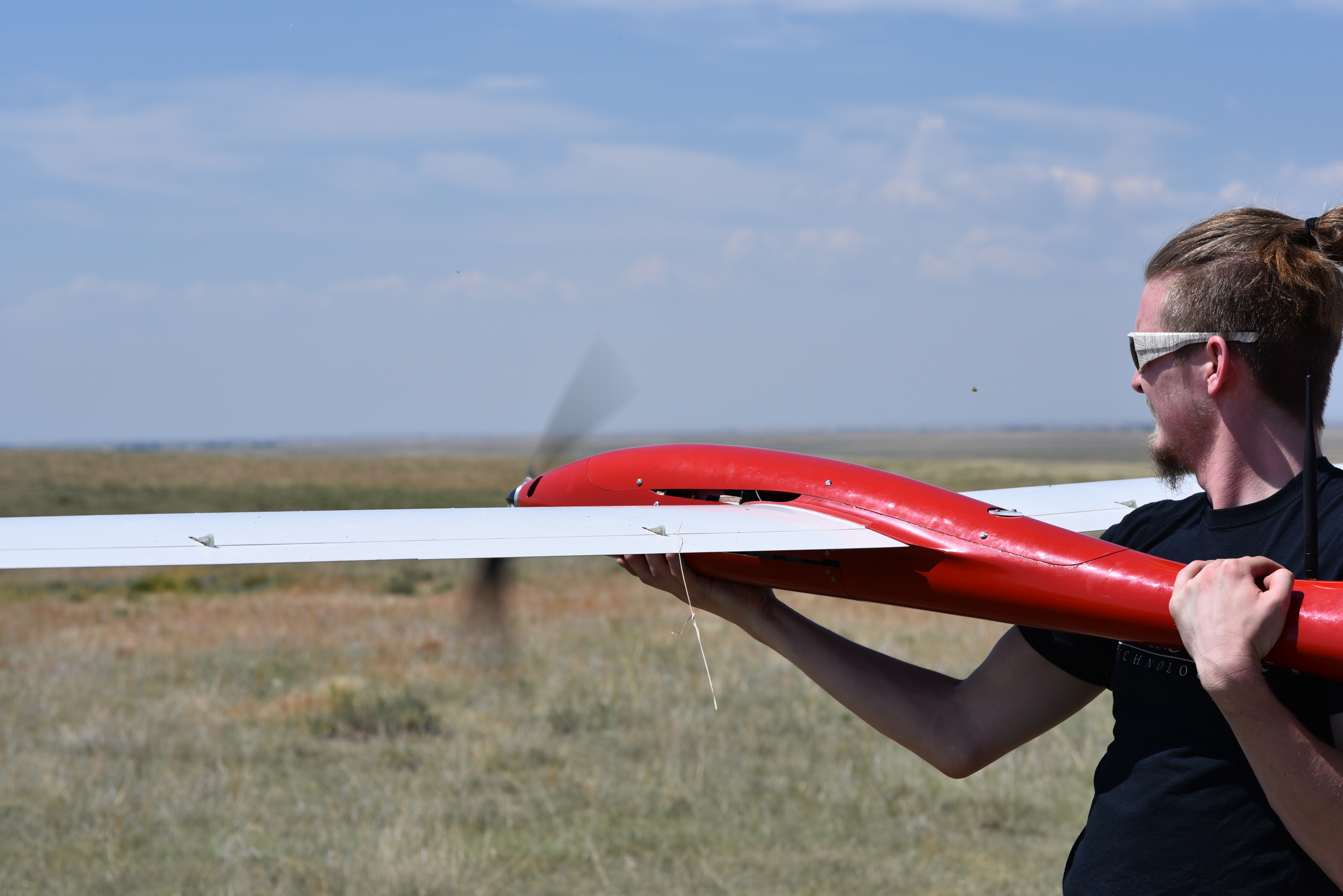
The first successful field campaign of the MALIBU (Multi AngLe Imaging Bidirectional Reflectance Distribution Function sUAS) system was conducted this summer at Pawnee National Grasslands in Colorado, marking the potential for improved land surface imagery, which is used by scientists and land use planners worldwide to monitor and plan for agriculture, climate and weather changes and effects, land use changes, species dynamics, and many other applications.
“In just 48 hours, the MALIBU/Tempest concept has beaten all our expectations, having fully met the established goals for Minimal and Comprehensive Success.” – Miguel Román, Terrestrial Information Systems Laboratory at NASA’s Goddard Space Flight Center
Miguel Román headed the project, which included this summer’s field campaign (see video link below) as part of a series of missions to develop a multi-angle reflectance measurement technique for land surface processes studies using small Unmanned Aircraft Systems (sUAS). The sUAS platform was chosen to assess and address difficulties in the retrieval of land biophysical parameters from satellite observations. There are several key factors that MALIBU measurements can address:
- Issues of satellite instrument stability and calibration
- Atmospheric correction
- Spatial scaling effects
- Directional reflectance anisotropy effects (BRDF)
The instrument package that Román and his team designed includes two multispectral imagers, which capture a specific range of frequencies from the electromagnetic spectrum (visible light, infrared, etc.), oriented at two different viewing angles, to capture vegetation structure and spectral reflectance characteristics. This is the type of data typically sought by land imaging systems. MALIBU’s advantage is that it enables both timely and accurate on-site data collection at a fraction of the costs of traditional NASA airborne science platforms, while significantly reducing the logistical and technical complexities of manned aircraft operations in remote geographical regions.
Another novel feature of the MALIBU system that will be tested is the capacity to sample both daily and seasonal landscape patterns under clear-sky conditions, which is often difficult to accomplish at high latitudes. This will enable accurate mapping of vegetation and climate dynamics (e.g., earlier spring snow-melt and plant emergence) and ecosystem phenology across plot- to landscape-level scales.
The end goal of this effort is to provide the international CEOS-Land Product Validation community (http://lpvs.gsfc.nasa.gov/) with spatially and temporally continuous reference datasets for the assessment of long term satellite data records, including:
- Spectral surface reflectance, Bidirectional Reflectance Distribution Function (BRDF) and albedo
- Burned area
- Photochemical reflectance index (PRI)
- Leaf area index (LAI)
- Fraction of absorbed photosynthetic active radiation (fAPAR).
The Department of Interior North Central Climate Science Center (NC CSC), housed at Colorado State University help provide logistic support for the campaign. The NC CSC director, Jeff Morisette, helped establish the CEOS LPV. Based on his experience with the early days of NASA’s Earth Observing System validation, Morisette noted, “I was impressed with the speed, agility, and (relatively) low cost for deploying this sensor. I believe it starts a new chapter in validation data and satellite under flights.
Check out a video from the campaign: https://youtu.be/Vd8c-4rXQOo
 Some key highlights from the campaign include:
-High-performance autopilot function, which allowed the science team to deploy MALIBU/Tempest at both AGL (variable height dependent on terrain) and MSL (near constant height).
-High angular sampling of surface reflectance anisotropy (aka BRDF) effects at 10 cm spatial resolution.
-Well-registered spectral channels (on-board navigation units worked as expected). Thanks go to Zhuosen Wang for generating with the first-light over the Pawnee calibration site.
-Excellent ground-support. This included deploying multiple calibration targets (for radiometric and atmospheric correction) and ground control points (for additional geolocation post-processing). Thanks go to Nima Pahlevan, Joel McCorkel, Jeff Morisette, and Eddie Saenz.
-Very quick turnaround between flight deployments (i.e., ready for the next flight in <1hr). This allowed the science team to conduct measurements during a Landsat-8 OLI overpass (Flight #003).
The work was funded under NASA Goddard’s International Research and Development (IRAD) program, the NOAA/NASA Joint Polar Satellite System (JPSS), and NASA’s Terrestrial Ecology program.
Connect with EcoPress on social media! Like us on Facebook and follow us on Twitter, @nrel_science, for more stories and news.