Are you looking for unique ways to expand your skill set and develop new capacities in this unprecedented time that demands incredible adjustment to our personal and professional lives?
Alicia Tyson, a PhD student in the Dept. of Geosciences and affiliated with NREL shared her experience as a volunteer with Urban and Regional Information Systems Association (URISA) GISCorps and detailed how the organization offers the opportunity to participate in real-time science as service. The maps and data produced by URISA’s GISCorps volunteer teams also help bridge the gap between scientists, practitioners, and the public by demonstrating the power of data visualization. Since 2004, a diverse range of services developed by the global network of volunteers works to address needs for humanitarian relief, disaster response, community development, local capacity building, conservation, health and education. In 2019, 160 GISCorps volunteers helped carry out 25 projects ranging in theme from developing an administrative dashboard for the Mountain Rescue Association, to a crowdsourced story map for the FEMA National Response Coordination Center during Hurricane Dorian response, to an open-source web mapping application for the Texas Justice Initiative. To date, 12 projects were launched in 2020.
Over the years, the projects have been diverse and highly dynamic in scope and scale. Recent projects related to ecology, conservation, and food and water nexus include:
- Developing Crop Yield Prediction Models for the Food Aid Project
- Mapping Green Space in Oregon
- Consolidation of Camp Fire Damage Data in California
- Supporting WWF (Worldwide Fund for Nature) Zambia’s Journey of Water Project
- Conducting a GIS Needs Assessment in Costa Rica’s National Forestry Financing Fund
- Measuring Tree Cover in Riparian Corridors in Southwestern Panama

So, what attracted Alicia to offer service to GISCorps?
“As if the value of the projects listed above are not reason enough, the experiences build community, professionally and personally. I have also found direct application of experiences and capacities honed in connection with my PhD research in Puerto Rico positioned within the realms of disaster risk reduction and sustainable land use and water resource management,” says Alicia.
Most recently she joined the following two projects:
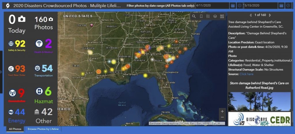
- An emergency response effort to map impact from a string of tornadoes that hit much of the Southeast United States
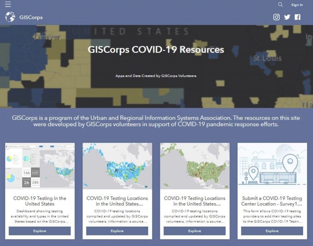
- And a herculean and timely project to map locations of COVID-19 testing centers across the United States, Puerto Rico, and all U.S Territories.
Holly Torpey, URISA GISCorps GIS and Admin Assistant, also shares that “GISCorps benefits those just entering the field and provides exposure to other fields and niches you might not have an opportunity to work in. It also helps build your network by working side by side with various partner agencies. Almost anyone can volunteer and gain valuable hands-on experience.”
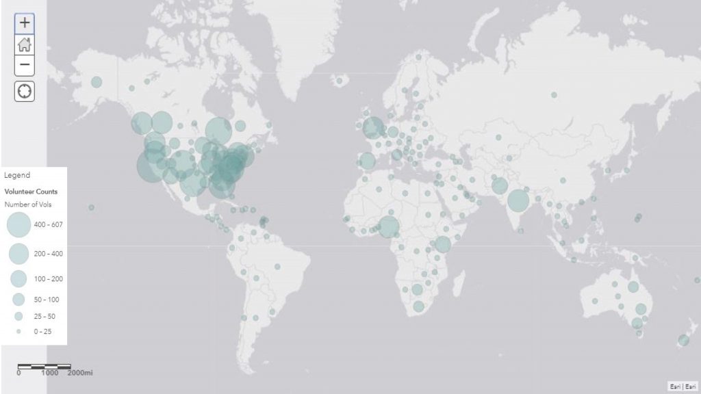
Torpey also states that the COVID-19 mapping effort drew over 600 volunteers with over 250 creating point data. There is now a core team who consistently contribute to the bulk of the maintenance and development. In addition to volunteering your time, there are currently two other priority needs at this time:
- Help get the word out and encourage your local healthcare service centers and public health departments to link directly to the map dashboard.
- Invite testing center managers, healthcare providers, and public health departments to submit information about their testing sites via the Survey123 submissions form.
Click here for more information about how to join URISA’s GISCorps. Another facet of service is the opportunity to develop your own project with an organization of your choice about a research or personal area of interest in partnership with GISCorps and ESRI through the GISCorps GIS Service Pledge.
Contributed by Alicia Tyson, M.A., M.S., and PhD student in the Department of Geosciences, CSU