
By Amanda M. West
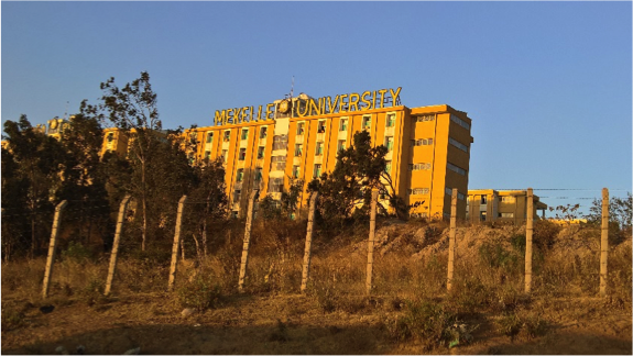
From February 6th – 17th, 2017 a team from the Natural Resource Ecology Laboratory (NREL) led a Geospatial Training workshop hosted by Dr. Daniel Teka, the Director of The Institute of Geo-information & Earth Observation Sciences (I-GEOS) at Mekelle University in Ethiopia. This workshop was supported by the Secondary Cities Initiative, Office of the Geographer, U.S. State Department; Dr. Melinda Laituri is the Principal Investigator of this Initiative, and Dr. Paul Evangelista is the Principle Investigator for the Mekelle node. The goal of Secondary Cities project is to build partnerships to create geospatial capacity, enhance understanding through data and mapping, and enable science-based decision making.
Secondary Cities are the fastest growing urban areas in developing countries, experiencing unplanned growth and development. These cities are unique environments that have generally been poorly mapped with limited data and information on infrastructure, land tenure, and planning.
The project defines secondary cities “not only defined by population, size, function, and economic status, but by the neighboring and/or distant cities and their socio-economic status. The population of a secondary city may range between 10-50% of the country’s largest city. 2Cs are urban centers providing critical support functions for governance, transportation and production services. A secondary city may emerge from a cluster of smaller cities in a metropolitan region or may be the capital city of a province, state, or second-tier administrative unit within a country.”
Background
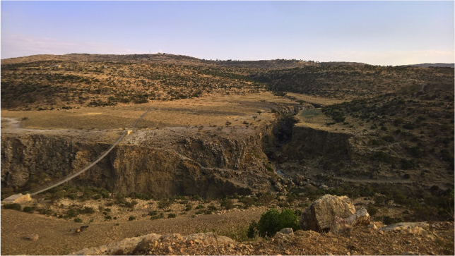
Mekelle, also known as Mek’Ele, is the capital of the Tigray Regional State located in the stunning semi-arid landscape of the northern Ethiopian highlands. Tigray is well known in African history: on March 1, 1896 the Ethiopian Empire secured their sovereignty against the Kingdom of Italy in Tigray during the Battle of Adwa. Likely founded by salt traders in the 13th century, Mekelle was already a center of Ethiopian politics and commerce at this time. Today, Mekelle has remained a hub of Ethiopian politics, economics, education and culture. It is considered an important city in Northern Ethiopia with close proximity to the Red Sea, Eritrea and Sudan. The government is currently strategizing improvements in water quality and quantity for the residents of Mekelle and the surrounding region. Geospatial data production, modeling, and analyses are vital tools to a broad range of stakeholders in this context, from city water delivery infrastructure planning to conservation of catchment zones and the surrounding watersheds that are critical to these services.
Universities can provide a foundation for training in geospatial tools, and can partner with local stakeholders to facilitate planning, implementation, and evaluation of water service programs. Under the Secondary Cities Initiative, NREL and I-GEOS are using a combination of classroom instruction with on-line resources to teach and produce high-priority digital maps of infrastructure, land-use, and water resources in Ethiopia that will improve self-governance, conservation, and sustainability of water resources.
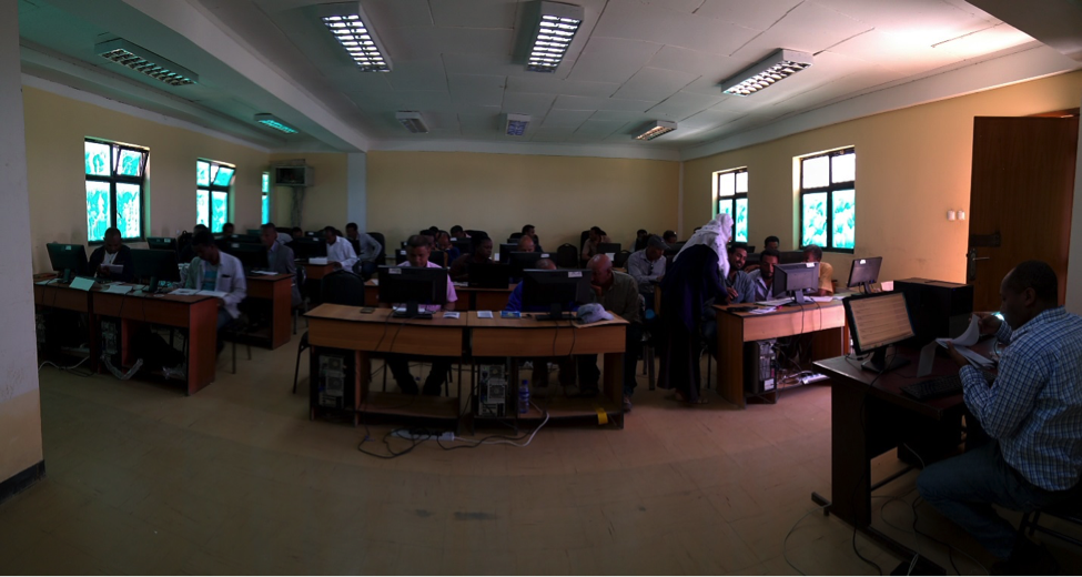
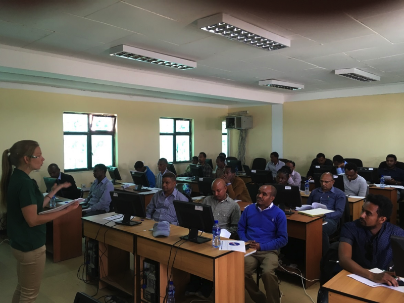
Thirty-two participants completed the workshop and earned certificates in Geospatial Training. These participants included eighteen faculty from seven unique departments at Mekelle University, one faculty from Axum University, eleven staff from the Mekelle City Government Water Supply and Sewage Office, and two staff from the Relief Society of Tigray (REST), a local NGO.
Participants completed eleven tutorials in geographic information systems (GIS) and applications, three lessons in global positioning systems (GPS), and ten lessons in remote sensing. More advanced participants also completed an applied remote sensing lesson. All tutorials and associated data were developed by Dr. Paul Evangelista’s lab group at the NREL and are available at the open-source webpage titled Geospatial Lessons and Applications in Natural Resources; Online Resources for Ethiopian Practitioners. Importantly, these tutorials are place-based; all examples and associated geospatial data are from Ethiopia. Several of the participants commended us on our selection of familiar geographic localities for the tutorials, indicating that it made the material more easily understood than former trainings they had attended using data from other geographic areas.
We are excited to report that in addition to completing the tutorials, participants began creating new geospatial data for Mekelle, Ethiopia during the open lab time of the workshop. Examples of data produced include polygons with associated attributes for schools, market areas, bus stations, and places of worshop in Mekelle, and polygons with associated attributes for watersheds, hydraulic structures, and irrigated agriculture in the Tigray region. Existing data from Open Street map were downloaded and additional attributes were added, such as local names for major roads in Mekelle (importantly, most of the roads in Mekelle do not have names; navigating relies primarily on local knowledge). Using Worldview III imagery, a normalized difference vegetation index (NDVI) was developed for the region and used to map vegetation cover. Additionally, a change in NDVI between two years was evaluated using Landsat 8 imagery, and a modified normalized difference water index (MNDWI) was developed. Participants from Mekelle Water Supply and Sewage Office and REST shared data from their respective institutions that included polygons of water pipelines and associated valves, fire hydrants, and bore holes for the city of Mekelle. These participants expressed their appreciation for some of the methods learned during the workshop that will be used to augment and enhance these important datasets moving forward.
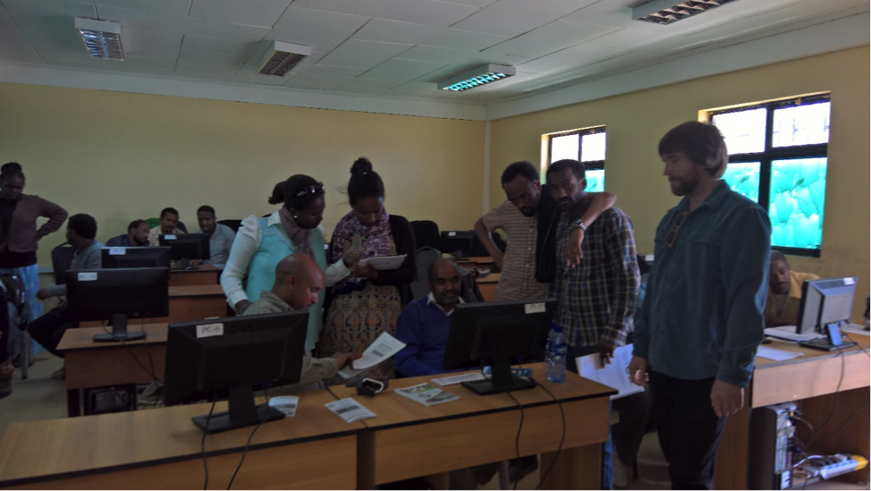
At the onset of the workshop, we planned to separate participants into two unique groups based on their level of education and expertise in GIS. However, after logistical considerations and in agreement with I-GEOS, we decided to hold the workshops in one I-GEOS computer laboratory with 24 computers. This resulted in increased engagement and knowledge sharing between workshop participants. Some of the faculty from Mekelle University, especially those with I-GEOS considered the tutorials introductory and completed them in less time than other less experienced participants. However, the former participants readily assisted the latter participants with minimal oversight from us. This was encouraging, and could indicate the partnerships established during the workshop will ensure the long-term success of the Secondary Cities Project in Mekelle. Furthermore, the more advanced faculty participants indicated that they plan to incorporate examples from the tutorials into their existing geospatial curriculum.
Looking Ahead
During the next six months, IGEOS will work in collaboration with all workshop participants and Colorado State University to process and complete quality control on all geospatial data produced during and after the workshop before uploading to the Secondary Cities GeoNode website, at http://secondarycities.geonode.state.gov/. We anticipate the working relationships that were formed among participants during the Secondary Cities Geospatial Training Workshop coupled with their interest in maintaining an open-source repository for geospatial data will ensure the sustainability of the Mekelle node on the website. We look forward to observing the continued data production of all project participants, and maintaining invaluable collaborations that were cultivated by the Secondary Cities Project.
Amanda M. West is a Postdoctoral Fellow with the Natural Resource Ecology Laboratory at Colorado State University (CSU), and was the lead instructor for the workshop. Her primary research interests include geospatial modeling and remote sensing in ecology and conservation. She is actively developing geographic information system (GIS) and remote sensing tutorials and continues to teach these methods at universities and NGOs in the USA, Ethiopia, and Indonesia. Concurrent to her Postdoc position, she serves as a Scientific Advisor for the NASA DEVELOP program at CSU, in collaboration with the USGS.
Acknowledgements: Dr. Amanda West would like to thank Dr. Tewodros Wakie and Mr. Brian Woodward (CSU) who co-instructed the two-week Secondary Cities Geospatial Training Workshop at Mekelle University, as well as to Amina Abdelkadir Mohammedshum (I-GEOS) who also provided support.
Connect with EcoPress on social media, like us on Facebook and follow us on Twitter, @nrel_science, for the more stories and news.