
By Dr. Dave Swift
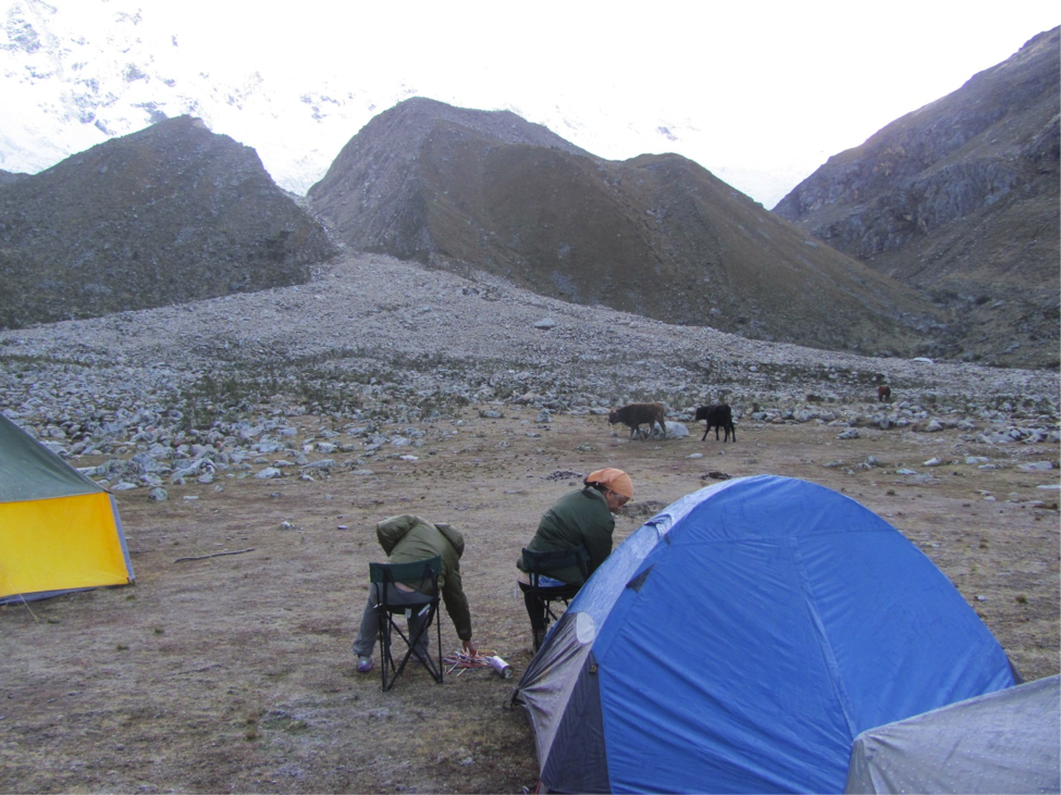
About a month ago I wrote an article for EcoPress about a very interesting trip I took with my wife and friends on the Peruvian Amazon. Now I don’t want you to think the Amazon is all Peru has to offer. Peru is an enormously diverse and interesting place geographically, ecologically and culturally; and the Amazon and its people are only part of the total picture. Peru, also, is right at the forefront of the ongoing struggle with climate change. That’s what I’d like to talk about here.
Setting the stage
The capital of Peru – Lima – is the 2nd largest desert city on Earth (after Cairo). It has a population of almost 9 million people and an average annual precipitation of less than 1 inch. This could be a real problem for water availability. Lima sits on the West coast of Peru which is really the northern extension of the Atacama Desert stretching from the coast of Chile to the south. There are places along the coast where rainfall has never been recorded.
This remarkable aridity is due to the Humboldt Current, an upwelling of deep, cold, nutrient rich water along that coast. The upwelling results in a very productive and important fishery – crucial to the ceviche industry in Peru – but also in a very arid coast. It works like this: The surface of the sea near the coast is colder than the surface of the adjacent land. The onshore winds bring cool air saturated with water vapor, but as the air warms over the land, the relative humidity falls, and rain does not. So you have a paradoxical situation of a foggy coast but no real precipitation.
This is not the source of Lima’s drinking water. Their water comes from the Andes to the East. North and east of Lima are the two main spines of the Andes in Peru, the Cordillera Negra and the Cordillera Blanca. The Cordillera Blanca (so called because of its extensive snow cover) is the eastern spine and gets its moisture during its rainy season when moist air rises up from the Amazon basin to the east and deposits snow in the upper elevations of the cordillera. The mountains here run to over 20,000 feet above sea level. The Cordillera Negra is in the rain shadow of the eastern range and gets less precipitation.

The glaciers of the Cordillera Blanca
The abundant snowfall in the Cordillera Blanca and its lofty elevation have resulted in the formation of the greatest concentration of tropical glaciers in the world. It is primarily the meltwater from these glaciers that provide Lima with its water and the rest of the country with water for irrigation and hydro-power. These tropical glaciers function differently than ours in Colorado. In the Colorado mountains, glaciers and the snow pack build up during the winter and then melt rapidly during spring and summer. The high latitude glaciers such as those of Alaska work like that also. But the tropical glaciers of Peru don’t work as our temperate zone mental model would suggest. The glaciers there melt constantly at their lower ends because summer and winter don’t really exist. They are then replenished at their upper ends by the highly seasonal snowfall provided by moisture from the Amazon. The result is that even though the input to the system is highly seasonal, the streamflow that results is really quite uniform. Pretty much the exact opposite of the situation in Colorado.
This is very nice for irrigated agriculture and for hydropower and for the provision of water to Lima. Reservoirs don’t need to be built – the water is always coming down and storage is largely unnecessary. Ditto for hydro. Water to drive turbines is predictable and nearly constant through the year. So what’s the problem?
Climate change and its impacts
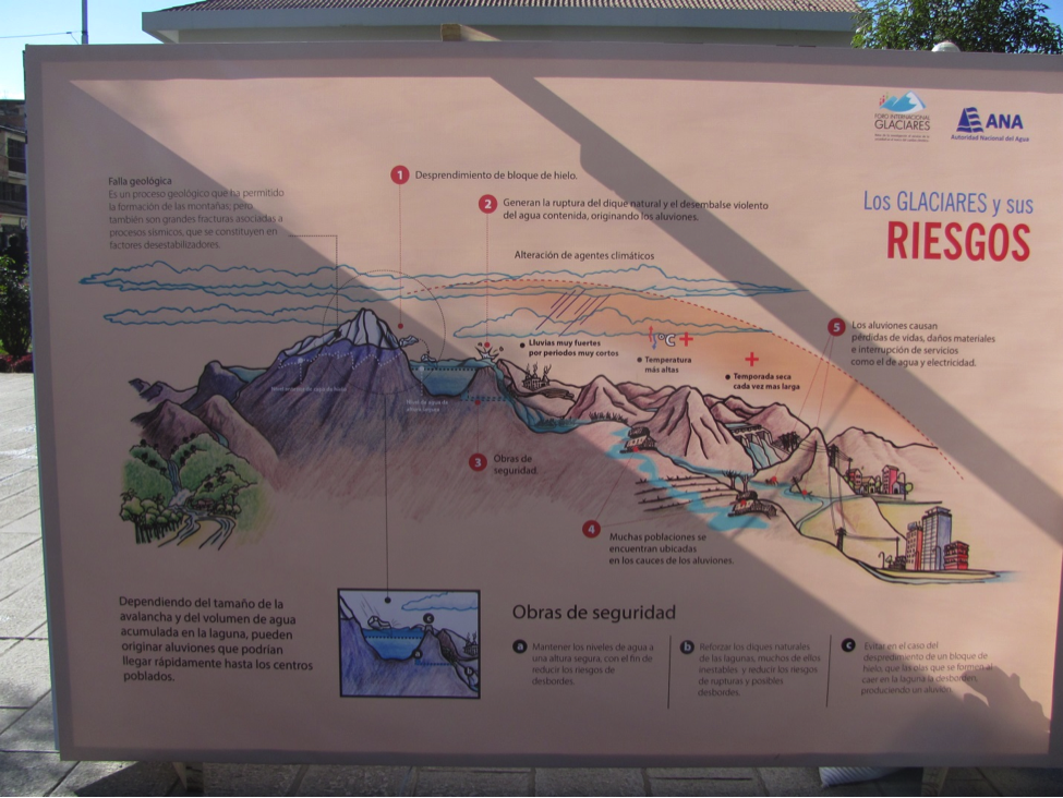
Well, the silly glaciers have been taken in by the climate change hoax and are rapidly retreating, likely resulting in all sorts of problems both locally and nationally. The effects at the national level can be pretty clearly foreseen. The loss of the glaciers will result in an increase in the seasonality and a reduction in the predictability of streamflow leading to a need for reservoir construction. Further, there will likely be a reduction in annual streamflow because at present the glaciers are in negative balance – releasing more water than they are receiving as input. When they are gone – or largely so – the output from the system will be limited to annual input.
The retreat of the glaciers is also problematic at the more local level in the Cordillera. The glaciers feed many of the high altitude wetlands that are important water and forage sources for the livestock of the people living in the mountains, and there is some danger that as the glaciers continue to retreat some of these wetlands will diminish or disappear.
Perhaps worse is the phenomenon known as “glacial lake outburst floods” – GLOFs. As glaciers retreat away from what had been their terminal moraines, lakes form behind the moraines and grow ever larger as they capture glacial melt. Sooner or later a big block of ice calves off a glacier and falls into the lake below. This produces a wave that runs down the lake. If it is large enough, it can overtop the moraine, and once this happens, the moraine – being pretty much unconsolidated junk - is breached, and the lake drains suddenly.
To make matters worse, the quebradas (drainages) into which these lakes discharge are as straight as a die having been formed by much earlier and larger glaciations. So the water tears down the quebrada at breakneck speed and slams into whatever town is sitting quietly at its end. This happened in 1941 when the terminal moraine that forms Lake Palcacocha was breached in this fashion. The resulting flood killed 5,000 people in the downstream city of Huaraz.
Since then efforts have been made to make these GLOFs less likely. The usual engineering approach is to construct a tunnel through the moraine that lowers the level of the water in the lake so that it would take a larger wave to overtop the moraine. This appears to be working so far, and it had better, because if Lake Palcococha produces another GLOF, it is estimated that the first of the flood waters will arrive in Huaraz in about 1 hour and 20 minutes with the peak flow arriving about 3 minutes later (Somos-Valenzuela et al 2016).
There are few climate change deniers in Peru, and one farmer has even brought suit against a large German energy company for its role in climate change and the resultant costs to Peru to protect against GLOFs.
Several researchers at the Natural Resource Ecology Lab (NREL) are working in the highland Andes to bring attention to the effects of climate change: Dr. Gillian Bowser has worked for over five years in the Cordillera Blanca with researchers in the field examining the impact of climate change on their socio-ecological systems. Additionally, Dr. Julia Klein is soon to release a documentary highlighting the complex interface of people and water in the highland Andes, as climate change is overlaid with political struggles for water de-privatization. Keep your eyes peeled for the next posts.
Dr. Dave Swift is a senior research scientist at Colorado State University, he focuses his research on large animal ecology and nutrition around the world.