Jody Vogeler
Lab Members
PATRICK FEKETY, RESEARCH ASSOCIATE
Patrick lives in Fairbanks, AK and works closely with researchers at the USFS Rocky Mountain Research Station Moscow, ID lab. His research interests include using remote sensing techniques to aid natural research management. Patrick’s work is primarily focused on a NASA Carbon Monitoring Systems project, which uses coincident field measurements, LiDAR, and Landsat time series data to predict aboveground biomass across the Pacific Northwest. Patrick received his Masters of Forestry from Oregon State University. His expertise includes LiDAR processing and imputation-based modeling of forest attributes. He has worked as a forestry technician with USFS and BLM and as a researcher with Michigan Technological University and University of Minnesota.
STEVEN FILIPPELLI, RESEARCH ASSOCIATE
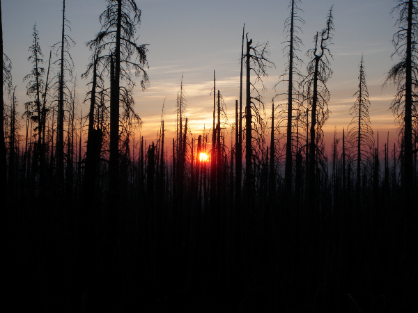
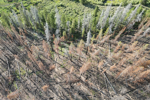
Steve measures trees from space! His research has involved combining lidar, high-resolution imagery, satellite image time series, and other remotely sensed data to track changes in forest structure. Steve’s recent work has primarily focused on quantifying woody encroachment and disturbance in the western United States and examining the implications of those dynamics for wildlife and carbon storage. This has involved applying a multitude of image processing and machine learning techniques to remotely sensed imagery, such as object-oriented analysis of aerial photos and Random Forest modeling with Landsat series. Steve obtained his master’s degree in Ecology from CSU where his thesis involved measuring the effects of wildfire on forest structure and biomass by fusing point clouds derived from aerial imagery and lidar. When Steve isn’t staring at trees on a computer screen he likes to visit them in real life by hiking and climbing in the Rocky Mountains.
Neal Swayze, Research Associate
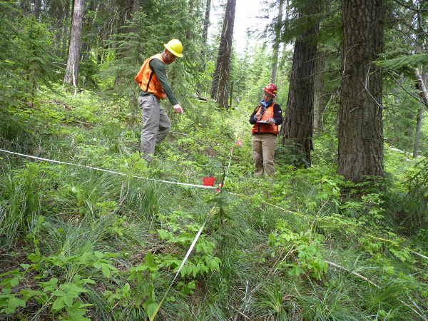
Neal is from Littleton, Colorado, and received his B.S in Ecosystem Science and Sustainability in 2018 and his M.S in Forest Sciences in 2020 from Colorado State University. His master’s research focused on comparing LiDAR and unmanned aerial systems (UAS) for forest structure characterization. Neal’s recent work has included using UAS for rare plant mapping with the Colorado Natural Heritage Program as well as working as a project team lead for NASA DEVELOP using satellite imagery to map 2020 Colorado wildfires and evaluate forest fuel treatment effectiveness. Neal contributes to a variety of lab projects fusing various remote sensing and field data sets for characterizing western U.S. forest systems. Neal is passionate about remote sensing, LiDAR, point cloud analysis, and natural resource monitoring. He is always exploring photogrammetry and 3d modeling in his free time and enjoys running and biking around Fort Collins.
Shahriar Shah Heydari, Postdoc
Shahriar has started from a pure engineering background in his home country of Iran but switched to environmental engineering due to his concerns on humans impact on our greater home. He carries a high level of experience in engineering project work from his past career, and traveled to Europe and USA to get another masters degree and finally a Ph.D. degree from State University of New York – Environmental Sciences and Forestry college, making him knowledgeable and skilled in geospatial analysis and mining of the remote sensing data. His research focus is land cover mapping, particularly by coding advanced artificial intelligence and deep learning methodologies and time series analysis and fusion of globally available big datasets. His work is also extending to change analysis and fine-tuning of developed powerful models for better local performance. He has also worked with state and local companies on surveying and generating prediction maps for forest health monitoring. On the ground and out of office, he is a true nature lover and spends his spare time mostly in the outdoors by hiking and biking, not only for peace but also for learning new things, which never stops.
Derek Fedak, PhD Student
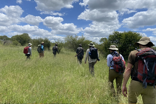
Derek is from St. Louis, MO and pursuing his Ph.D in Ecology. His research focuses on wildlife conservation, human-wildlife conflict mitigation, and habitat connectivity using a combination of fieldwork, remote sensing, GIS, and camera trap analyses. He is currently assessing how long-term land use/land cover changes and rewilding efforts are impacting the Greater Kruger National Park landscape to forecast potential scenarios to aid with management decisions. He received his B.S. in Biology from Boston College and M.S. from Duke University, where he studied tropical mangrove forests. Derek has conducted international fieldwork in Costa Rica, Mozambique, and South Africa and spent several years leading fieldwork throughout the northern range of Yellowstone, where he researched the impact that wolf reintroduction is having on riparian systems. He also researched stream restoration and willow survival in Rocky Mountain National Park. Derek spent several years in education teaching Biology, Geography, and Environmental Sciences in CO and WY before returning for his Ph.D. When not in the office, Derek likes to spend time hiking, biking, and SUP/kayaking with his daughter. He is also an avid trail runner that races over any mountain he can find.
Orion Cardenas-Ritzert, MS Student
Orion is from Homedale, ID, and is pursuing a Masters in Ecosystem Sustainability at Colorado State University. His research interests lie in addressing human-driven environmental and sustainability issues in urban environments and understanding the implications they have on the well-being of humans, peri-urban and urban ecosystems. He is also passionate about advocating for environmental justice and incorporates it into his work whenever possible. His favored approach for addressing these issues is through the utilization of remote sensing and spatial analysis techniques. Orion received his B.S. in Ecology and Conservation Biology, as well as certificates in GIS and Remote Sensing from the University of Idaho. His senior thesis examined the relationship between urbanization and land surface temperatures in Ada County, Idaho, as well as the potential impacts of increased land surface temperatures on socially vulnerable populations using a remote sensing-based approach. Orion’s master’s thesis work will contribute to a NASA project assessing urbanization patterns and the tradeoffs among social and ecosystem services associated with urbanization-driven Land Cover and Land Use Change in Africa.
ALUMNI
Eric Jensen, MS Student – Graduated Fall 2020
Thesis Title: Leveraging the Landsat archive to characterize plant species diversity and post-fire recovery in Great Basin shrublands.
Jillian LaRoe, MS Student – Graduated Summer 2020
Thesis Title: Characterizing distributions and drivers of emergent aquatic vegetation in Minnesota.